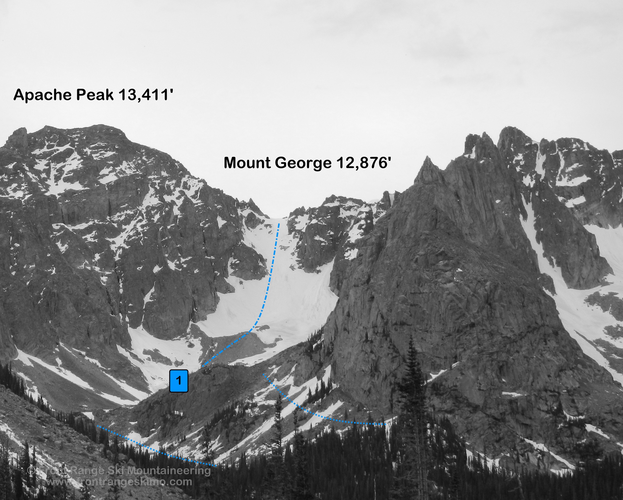
Mount George 12,876'
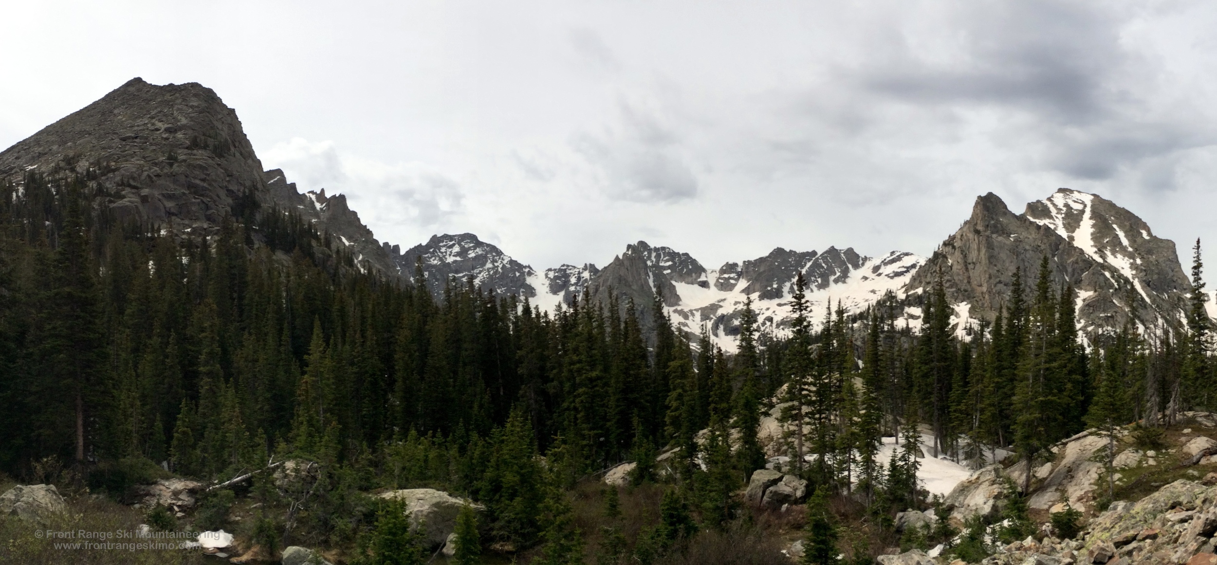
Apache and Mount George from the north. Photo: Rob Writz
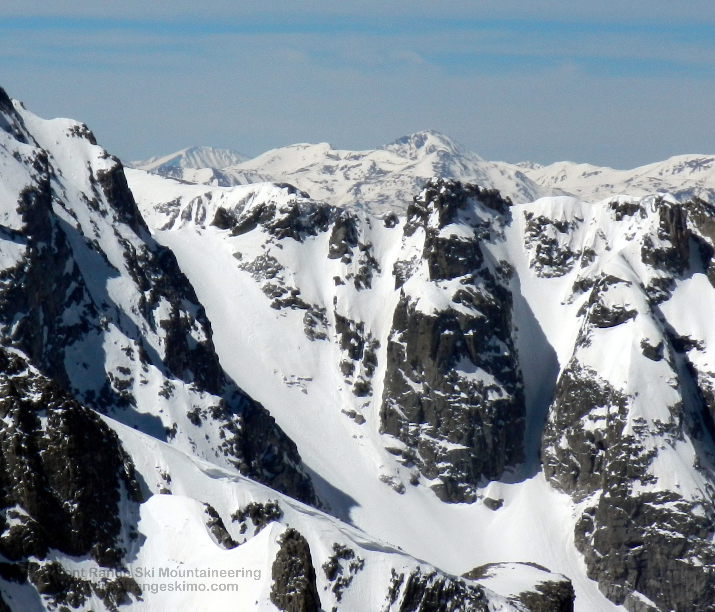
Mount George is but a small bump on the massive ridge that starts at Lone Eagle Peak and terminates on Apache Peak. The mountain top sits a few hundred feet above the Fair Glacier, and its name is distinctly out of place in Lone Eagle Cirque, the heart of the Indian Peaks. The Fair Glacier is really a part of Apache Peak, but for the purpose of this online guide we assign it to Mount George. As with the Brainard Lake side of the range, Apache dominates the Eastern Rim of the Lone Eagle Cirque. Dark and foreboding towers line the ridges, and the steep west facing chutes can fill with snow. Couloirs on Iroquois and Apache grace the approach to Fair Glacier. This region needs more exploring. Good thing you can ski in here through July!
+ ROUTES
Shared Approach to Fair Glacier and Mount George Couloir
There are several ways to access the ski mountaineering routes in the cirques surrounding Lone Eagle. The approach that we describe here is to start at the Monarch Lake Trailhead southeast of Lake Granby in Grand County. This approach is straightforward and beautiful.. You should plan on spending several days in this area: one day to hike in, several days to ski from a basecamp, and one day to hike out. No matter how long you stay in this area you will leave wishing you had planned for several more days because it is that good.
Most Front Range skiers explore the Lone Eagle area after Memorial Day. The Cascade Creek Trail is often dry to just beyond the junction of the Crater Lake Trail (approximately 10,080’). You will want to bring hiking boots for the majority of the approach, skins for the valleys below the cirque, and crampons for the glaciers and snowfields.
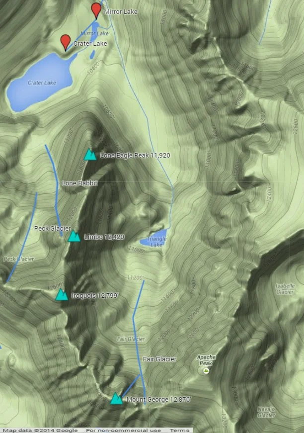
From the Monarch Lake Trailhead follow the Cascade Creek Trail east across the north side of Monarch Lake. The trail continues eastward 3.1 miles to the intersection with the Buchanan Pass Trail. Hike on the Cascade Creek Trail to the southeast 2.7 miles to the junction with the Pawnee Pass Trail and Crater Lake Trail. Cross Pawnee Creek and go south on the Crater Lake Trail, and within a half mile look for a camping spot to the east (left) in lower angle and sometimes dry terrain. There is often snow at Crater Lake, and this positions north and east of Mirror Lake are good for a basecamp. From this area it is about a quarter mile southwest to Mirror Lake and then a quick jaunt to Crater Lake.
Your goal on the approach to Fair Glacier is to reach Triangle Lake. From Crater Lake area there are two primary ways to get to Triangle Lake depending on the amount of snow cover. Earlier in the season, such as June, you can follow the east side of Cascade Creek that comes from the Fair Glacier. Follow Mirror Lake’s outlet creek to its intersection with Cascade Creek. Proceed on the general line of the creek up the valley towards Triangle Lake. There is more consistent snow on the shaded east (climber’s right) side of the valley. As you near the small headwall below Triangle Lake you will encounter more boulder fields, and you may be able to find snow on the climber’s left of these. The second approach for when there is minimal snow in the valley is to approach from Crater Lake. Go east from the lake and hug the base of Lone Eagle. Aim for a saddle between Lone Eagle and the knoll that is above Triangle Lake. At Triangle Lake you can continue up the valley to the glacier and begin the steeper snow ascent. It is about one mile from Mirror Lake to Triangle Lake. Regardless of your approach route, be prepared to scramble on talus and boulders.
Route 1 - Fair Glacier
- Rating: V* D11 R4
- Season: Summer
- Exposure: North
- Vertical: 1,800’
- Approach Elevations: 8,340’ – 12,700’
- Approach Distance: From Mirror Lake: 1.8 miles, From Monarch Lake TH: 8 Miles
The Fair Glacier is the premier wilderness ski mountaineering route on the Front Range. It is also the most sought after route in the Cirque, albeit your chance of seeing someone else on the glacier in June is slim. If you have been skiing on the Cirque’s West Rim Peaks (Hopi, Achonee) you will be relieved to find that there is no cornice at the top of the Fair Glacier. This area of the Indian Peaks does not see a lot of sun. If you are skiing here in consolidated spring and summer snow conditions, the top could remain frozen while the bottom sunlit snow turns to corn. Expect a very late sun exposure here, between 9 am and 10 am in the late spring. Overall, the skiing is spectacular. Hands down, this is one of the Front Range’s finest routes.
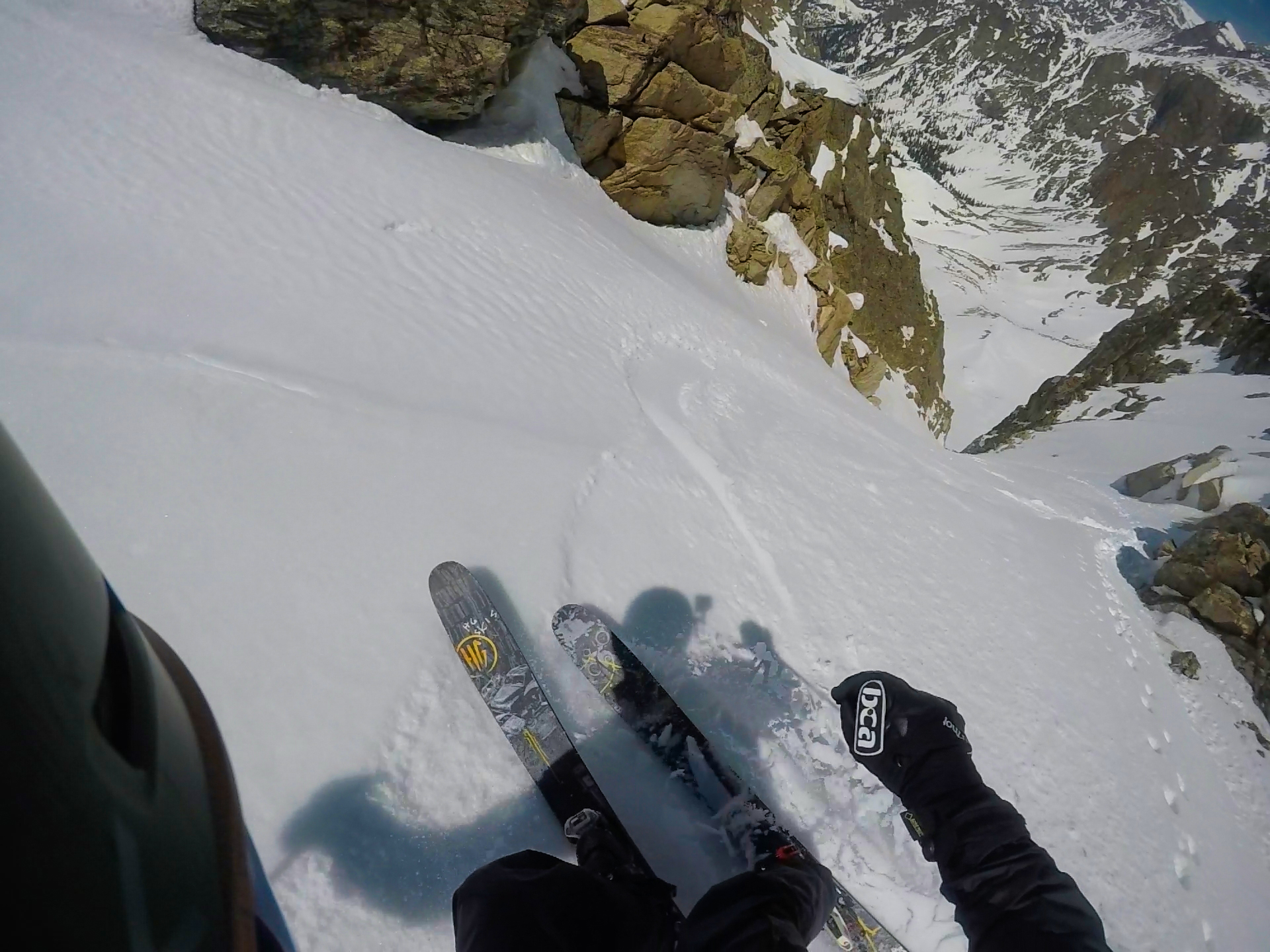
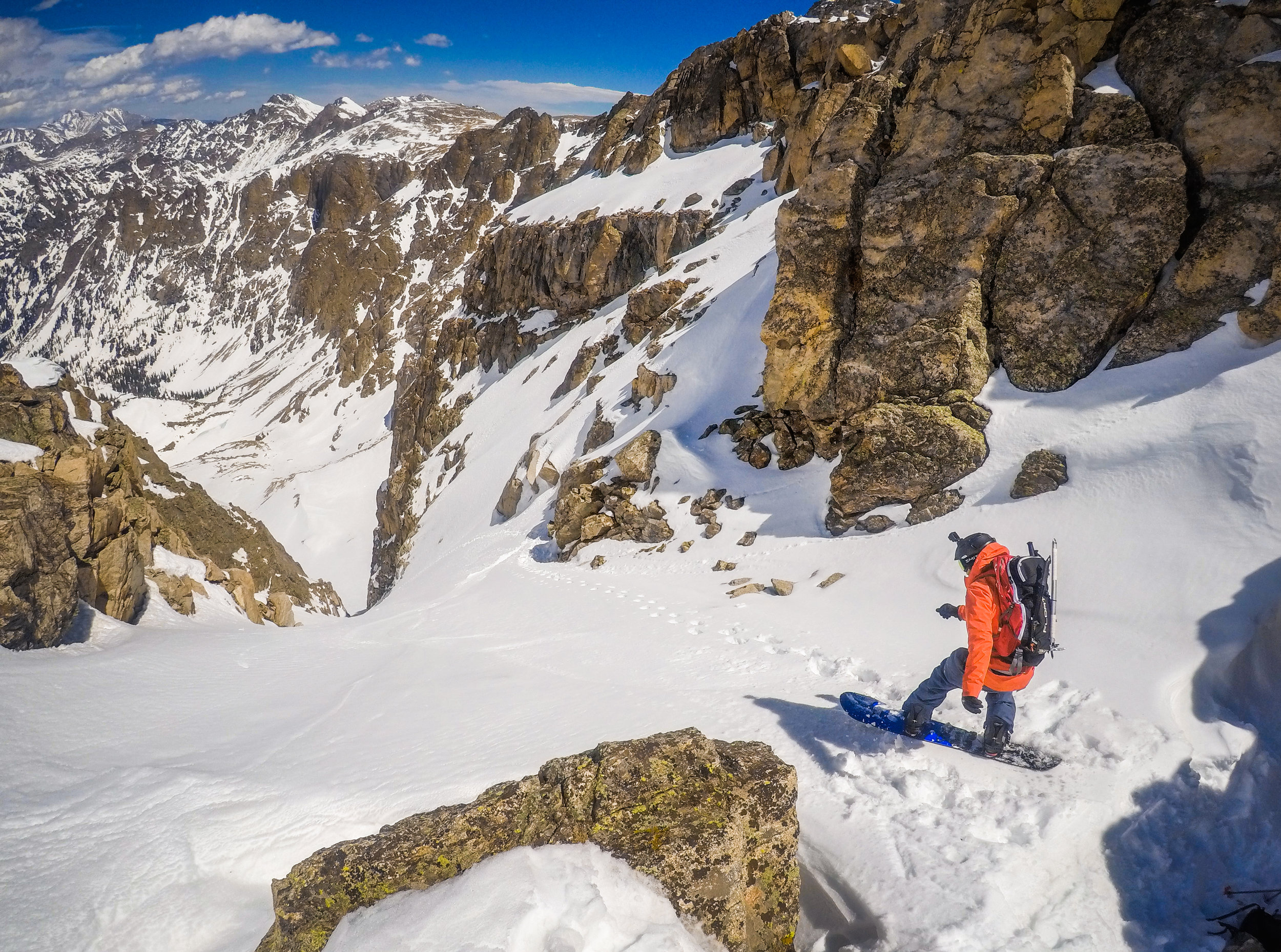
The glacier is wide and a moderate snow climb to about 12,200’. At this point the glacier narrows and the angle kicks up to 45 degrees. This is where a crevasse forms later in the summer, and hard ice becomes exposed. Be careful in this section. The upper portion of the glacier ends on a ridge extending from Apache Peak. To reach the summit of Mount George you can Class 3 climb and negotiate tricky cornice traverses for several hundred yards to the northwest.
Route 2 - Mount George Couloir
- Rating: V* D17 R4
- Season: Spring, Summer
- Exposure: Northeast
- Vertical: 1,200’
- Approach Elevations:8,340’ – 12,800’
- Approach Distance: From Mirror Lake: 1.8 miles, From Monarch Lake TH: 8 Miles
This steep, shaded, and gnarly couloir is an extension of the Fair Glacier. A successful climb and ski of this 55 degree line will result in being awarded the Steep Chute Merit Badge. The chute is located on the climber’s right side of the glacier near the 12,200’ point where the Fair Glacier’s crevasse forms. The couloir breaks right from the glacier and is on the right side of a massive buttress below Mount George’s summit. The couloir climbs straight through a narrow slot and then to a less steep perch on the ridge west of the summit of Mount George. In the summer, a crevasse forms at the bottom of this couloir where it joins the Fair Glacier.
The Mount George Couloir is one example of numerous extreme lines that drop off of the ridge that connects Apache, Mount George, Limbo, and Iroquois. The exploration potential on the East Rim of the Lone Eagle Cirque is enormous. You could spend several days in the cirque above Triangle Lake. A week long expedition to this area is needed to cover all of the potential lines.
*These are Grade III routes from a high camp in the Lone Eagle Cirque.
+ TRAILHEAD
Monarch Lake Trailhead (8,340’)
This trailhead is in the Arapaho National Recreation Area. There is a $5 per day vehicle fee and you can learn more about it at the ANRA website. Additionally, a wilderness permit is required for camping in the Indian Peaks Wilderness. The Arapaho and Roosevelt National Forest website has more information on this. The Sulfur Ranger District headquarters in Granby is a good central location for information on the recreation area and the wilderness area.
+ MAPS & PICTURES
Below we have included a link to a Google interactive map and a curated list of photos of the mountain.

Clicking on map above will open interactive Google map website